The smallest of Uganda's gorilla parks, sitting on the shoulder of the Virunga volcanoes, and the only place in the country where you can hike a summit and trek gorillas in the same trip.
The smallest of Uganda's gorilla parks, sitting on the shoulder of the Virunga volcanoes, and the only place in the country where you can hike a summit and trek gorillas in the same trip.
Mgahinga Gorilla National Park is Uganda's smallest national park, just 34 square kilometres, on the shoulder of the Virunga volcanoes at the far south-west corner of the country where Uganda, Rwanda and the Democratic Republic of the Congo meet.
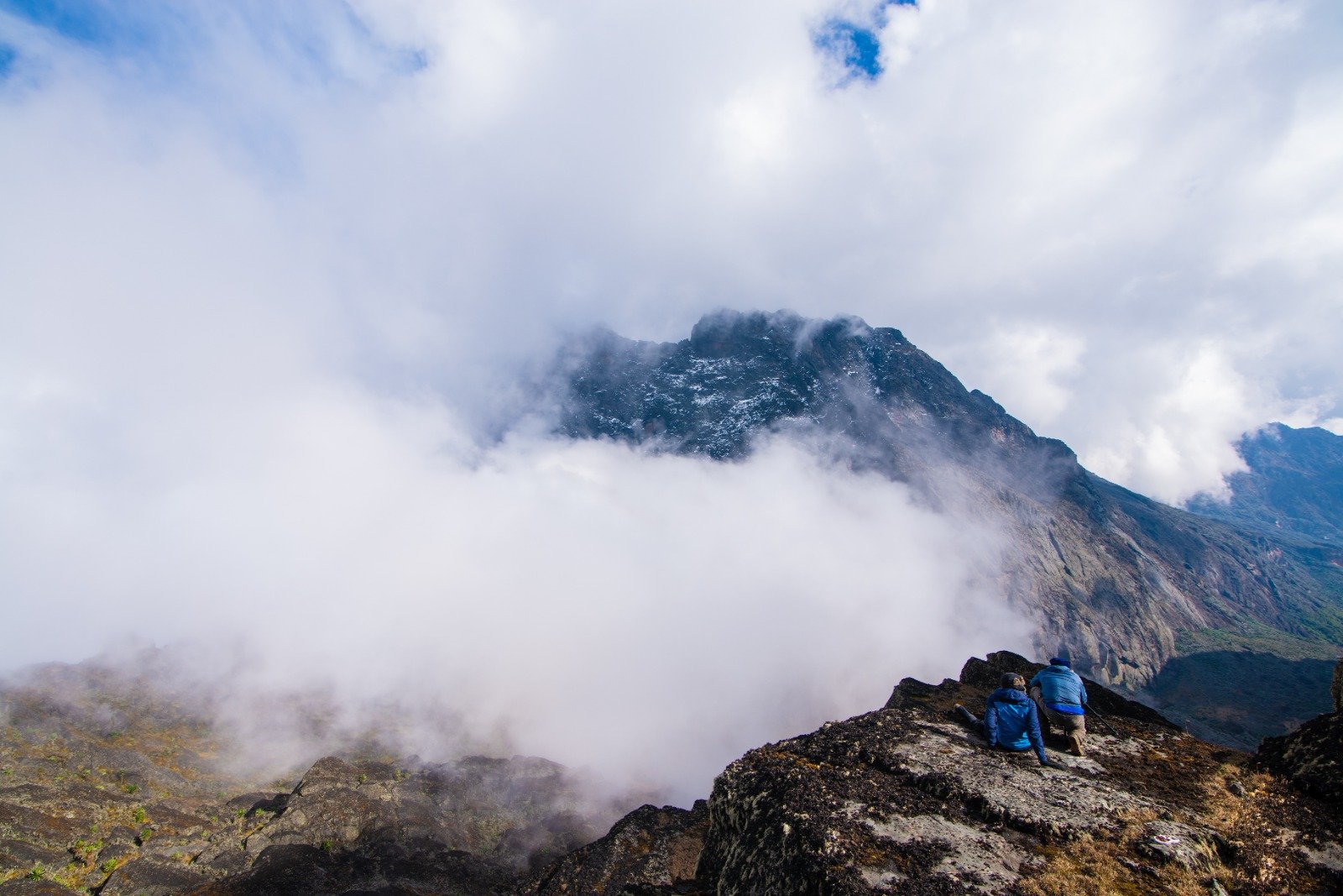
Three peaks define it. Mount Muhavura at 4,127 metres is the highest point in Rwanda and the sharpest climb. Mount Gahinga at 3,450 metres is a manageable full-day walk with a crater lake on top. Bisoke, on the border, holds a crater lake with black-and-white colobus monkeys.
The park is part of the Virunga massif, a transboundary UNESCO World Heritage Site shared with Volcanoes National Park in Rwanda and Virunga National Park in the Congo. The forest here is continuous across all three, which is why the gorillas move between them.
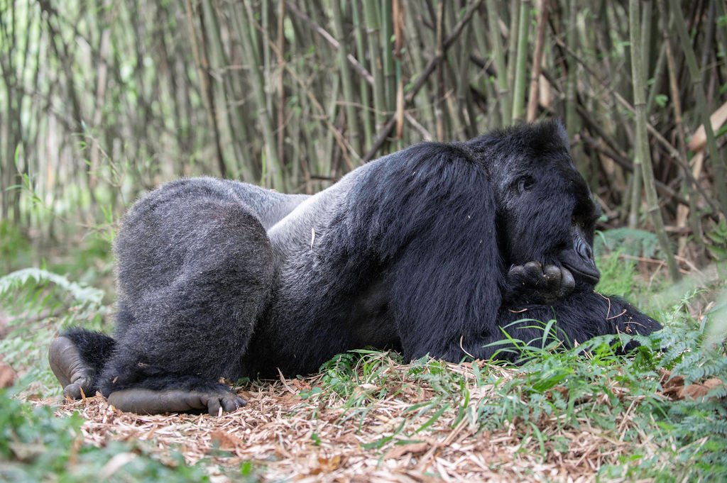
Three habituated gorilla families are open to visitors: Kwamwamby (Gisa), Munyakazi and Nimbatara. Numbers are small compared with Bwindi, which means a trekking permit here guarantees a much quieter forest and a shorter climb.
Mgahinga is also one of the best places in Africa for golden monkey, with roughly 500 living in the park, and for birding, with more than 130 species including Grauer's broadbill, the Rwenzori batwing and striped blue-butterfly mountain.

The smallest of Uganda's gorilla parks, sitting on the shoulder of the Virunga volcanoes, and the only place in the country where you can hike a summit and trek gorillas in the same trip.
Three habituated families, with a total population in the low hundreds across the wider Virunga range. The permit limit is eight trekkers per group per day, and because there are fewer trekkers than at Bwindi, the hour in the forest is noticeably quieter.
Around 500 golden monkeys live in Mgahinga, split across three troops in the bamboo and forest. They are strikingly golden in direct sun, and a dedicated walk to see them is a genuine speciality of this park.
Muhavura, Gahinga and Bisoke rise from the park floor. Hiking the two Ugandan peaks with a local guide is a full day's walk, and the summit reward is views across four national borders.
The bird list includes the endemic Grauer's broadbill, Rwenzori batwing, mountain masked apalis and Striped Blue-Butterfly Mountain, found on the open slopes above the forest.
Red colobus, black-and-white colobus, blue monkey, Uganda kob in the meadow clearings, and endemic African mountain mole-rats in the highlands.
The open high-altitude slopes carry giant groundsels and lobelias, a plant community found only on a handful of African volcanoes.
A full day: an early start from Buhoma, a climb through bamboo and forest, and a ranger-led hour with a habituated family. Fewer trekkers per permit than Bwindi.
Climb Gahinga (3,450 m) or Muhavura (4,127 m) with a local guide and porter. Both are full days on steep, muddy trails.
A dedicated walk with a park guide to one of the three troops. Best in the early morning.
A specialist park for Albertine Rift endemics, with a good chance of seeing species found nowhere else on an Ugandan itinerary.
Guided walks through lowland and highland forest, with small plant and butterfly interest in the wet season.
A walk through the local community with a guide who explains how the park's presence shapes daily life on the edge of the forest.
Lodges listed are indicative. Tell us your budget and lodge preference and we will match it when we build your itinerary.
| Location | Lodge | Basis |
|---|---|---|
| Buhoma sector | Mount Gahinga Lodge | Full Board |
| Buhoma sector | Buhoma Lodge | Full Board |
| Buhoma sector | Rugendo Hotel | Full Board |
| Kisoro town | Kisoro Jacaranda Lodge | Full Board |
Scheduled flights land at Kisoro Airstrip from Entebbe and Kihihi. From Kisoro it is a short drive to the park, roughly an hour to the Buhoma sector.
From Kampala it is around 440 km and nine hours via Mbarara and Kabale. From Bwindi it is about 80 km and two and a half hours, which makes the two parks an easy pairing.
Mgahinga and Bwindi sit on the same road. Most itineraries do two or three nights in each rather than three nights in one, and we can arrange the permits for both.
June to August and December to February give the driest trails for both trekking and volcano hiking. Mgahinga is wetter and cooler than Bwindi at altitude, and fog is common on the volcano slopes in the morning.
Mgahinga issues a limited number of permits per day across three habituated families. We confirm availability before you book, and the permit is usually cheaper than Bwindi for the same experience.
Muhavura is a serious climb of around three hours each way on steep, muddy ground. Gahinga is easier but still a full day. Hire the porter and guide at the gate; it is inexpensive and expected.
Uganda offers e-visas online and visas on arrival at Entebbe. Because Mgahinga sits on the Rwanda and Congo borders, travellers crossing into either country should ask us about the East Africa Tourist Visa.
These are the itineraries our travellers book most often for this destination. All can be adjusted to your dates, pace and budget.